rareoldprints.com
Antique Maps of Germany
4
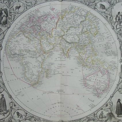
Germany, Divided into its Great Circles and their Subdivisions. Drawn from the best authorities, by J. Russell.
Ref:
P/30087
Region:
Germany
Type: Copper
Cartographer:
Russell J
Engraver:
Russell J
Publisher:
Wilkie & Robinson, J. Mawman and other Proprietors
Date:
1811
A New Map of Germany Divided into Circles for the Best Authorities
Ref:
P/2030
Region:
Germany
Type: Copper
Germania Antiqua
Ref:
P/2953
Region:
Germany
Type: Copper
Cartographer:
Hall S
Engraver:
Hall S
Publisher:
Longman, Rees, Orme, Brown & Green, Paternoster Row
Germany
Ref:
P/4907
Region:
Germany
Type: Steel
Cartographer:
Rapkin J
Engraver:
Rapkin J
Publisher:
J & F Tallis
Europe
Germany
Maps
12
Germany
Constance
Dresden
Frankfurt
Hamburg
Kalkar
Munich
Weimar
1
2
1
1
1
1
1
Germany
Views
151
Aachen
Andernach
Bacharach
Bad Ems
Bad Godesberg
Bad Kissingen
Bamberg
Bastei
Berlin
Bielstein
Bingen
Bonn
Boppard
Bornhofen
Brambach
Braubach
Bruhl
Coblenz
Cologne
Drachenfells
Dresden
Ehrenbreitstein
Frankfurt
Friedrichshafe
Godesburg
Hamburg
Hamburgh
Hammerstein
Hanover
Heidelberg
Heisterbach
Hohenheim
Koblenz
Konigswinter
Kulm
Laach See
Lahnstein
Leipsig
Lichtenstein Castle
Lorelei
Mainz
Meersburg
Munich
Nonnenwert
Nuremberg
Nyphenburg
Oberwesel
Passau
Potsdam
Regensburg
Remagen
Rheinstein
River Rhine
Rothenbourg
Rudesheim
Salzburg
Sankt Goar
Schweidnitz
St Goar
Stolzenfels
Uhldingen-Mühlhofen
Uttewalde
Wasserburg
Wettenburg
Wetzlar
Wiesbaden
Worms
Wurzburg
!Other
1
8
2
1
1
4
3
1
6
1
2
3
2
1
1
2
1
4
16
1
6
1
9
1
1
4
1
1
1
5
1
1
1
1
2
1
2
1
1
1
2
1
5
1
4
1
1
2
1
1
3
2
1
1
1
1
1
2
1
1
1
1
1
1
1
2
2
1
5
.
.