 | Wiltshire County Maps
72 74 : Dix, Thomas 1816 |
| |
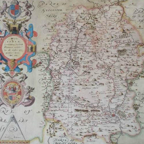
From a series of county maps surveyed by Thomas Dix. Dix died in 1813 and the series was completed by the publisher William Darton who published them in atlas form in 1822. Maps in the atlas bear dates ranging from 1816 to 1821. Wiltshire is thus one of the earliest. It's very likely that these earlier maps were issued as loose sheets before the atlas appeared. Wiltshire certainly was issued as a folding map on linen, in a slipcase. Two characteristic features of the maps are the vignette views and circular title frames. Wiltshire's view is of the nave of Malmesbury Abbey, copied from the engraving that appeared in Britton's "Beauties of England and Wales".
A second issue was published by William Darton & Son in an atlas of 1835, with completely re-engraved titles, without the circular frame and with Thomas Dix's name removed. These maps include the new parliamentary divisions. Maps in this series were also sold separately as folding maps on linen.
Both issues are quite rare.
|
Examples (3)
 | Ref: 5679
State: 1
Title: A New Map of the County of Wiltshire divided into Hundreds by Mr Thos. Dix
Date: 1816
Not for sale |
|
| Ref: 32234
State: 2
Title: A New Map of the County of Wiltshire divided into Hundreds by Mr Thos. Dix
Not for sale |
|
| Ref: 26157
State: 3
Title: Wiltshire Divided Into Hundreds, and the Parliamentary Divisions.
Date: 1835
Not for sale |
|
|
| Wiltshire County Maps |
1
2
3
4
5
6
7
8
9
10
11
12
12.1
13
14
15
16
17
18
19
20
21
22
23
24
25
26
27
28
29
30
30.1
31
32
33
34
35
36
37
38
39
40
41
42
43
44
45
46
47
48
49
50
51
52
53
54
55
56
57
58
59
60
61
62
63
64
65
66
67
68
69
70
71
72
73
74
75
77
78
79
80
81
82
83
84
85
86
87
88
90
91
92
93
94
95
97
100
101
102
103
201
202
203
204 | Saxton, Christopher
Bowes, W
Van den Keere, Pieter
Bowes, W
Saxton-Kip
Speed, John
Drayton, Michael
Bill, John
Van Langeren, Jacob
Jenner, Thomas
Blaeu, Jan
Jansson, Jan
Overton, John
Blome, Richard
Blome, Richard
Morden, Robert
Redmayne, William
Seller, John
Morden, Robert
Morden, Robert
Lenthall, John
Owen & Bowen
Moll, Herman
Seale, Richard William
Badeslade, Thomas
Cowley, John
Rocque, John
Simpson, Samuel
Osborne, Thomas
Kitchin & Jefferys
Kitchin, Thomas
Exshaw, John
Seale, R W
Bickham, George
Bowen, Emanuel
Bowen, Emanuel
Gibson, John
Meijer, Pieter
Kitchin, Thomas
Bowen, Emanuel
Ellis, Joseph
Bowen, T
Kitchin, Thomas
Andrews & Dury
Conder, Thomas
Cary, John
Harrison, John
Cary, John
Cary, John
Lodge, John
Aiken, John
Tunnicliff, William
Baker, Benjamin
Smith, Charles
Cary, John
Luffman, J
Butters, R
Cary, John
Cooke
Cooper, H
Roper / Cole
Cary, John
Wallis, James
Wallis, James
Neele, Samuel John
Rowe, Robert
Langley & Belch
Neele, Samuel John
Hall / Leigh
Neele & Son
Reid, W.H.
Greenwood, C & J
Miller, Robert
Dix, Thomas
Cary, John
Gardner / Smith
Perrot, Aristide Michel
Ebden / Duncan
Pass, J
Greenwood, C & J
Murray, T L
Teesdale, Henry
Creighton, R
Hall, Sidney
Dawson, R K
Nichols & Son
Cobbett, W
Fullarton, Archibald
Archer / Pinnock
Creighton, R
Walker, J & C
Moule, Thomas
Pigot, J
Pigot & Slater
Archer, J
Becker & Co
Bacon
Bartholomew / Philip
Hughes, W
Bartholomew / W H Smith
Weller, Edward
Johnston
Johnston
Weller, F S | 1579
1590
1605
1605
1607
1611
1612
1626
1635
1643
1645
1646
1675
1668
1673
1676
1676
1694
1695
1701
1717
1720
1724
1732
1741
1743
1744
1746
1748
1749
1751
1751
1762
1754
1755
1755
1759
1757
1763
1764
1765
1767
1769
1773
1784
1787
1788
1789
1789
1790
1790
1791
1796
1804
1801
1803
1803
1806
1806
1808
1809
1809
1812
1813
1813
1814
1817
1818
1820
1820
1820
1820
1821
1816
1822
1822
1823
1825
1828
1829
1830
1830
1831
1832
1832
1832
1832
1833
1833
1835
1835
1836
1838
1841
1842
1845
1858
1862
1868
1868
1872
1887
1889?
1894 |
|
|